Nathan Todd is currently a Research Assistant for Data Driven Streets where he is actively involved in two projects. These two projects, the Crash Prediction Model and the Satellite Imagery Analysis using Neural Networks, provide predictions and valuable insight that contribute to making DC streets safer.
Crash Prediction Model
Nathan has been working on a Crash Prediction Model for about the past six months. This project uses extensive data collected from various dispatch calls, which DDS has compiled into a comprehensive table. The table serves as the foundation for the model. Using this data, Nathan began training a linear regression model to predict the number of crashes expected in a given year. This model takes into account factors such as speed limits for each roadway segment, annual average daily traffic, number of lanes, and lane width. After applying these variables to the DC area the model predicts annual crash counts. Nathan then combined these results as a difference between the actual number of crashes and the predicted number of crashes, as shown in Figure 1.
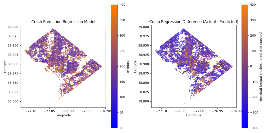
Figure 1: Comparison of Crash Prediction Regression with Crash Regression Difference
The graph on the left of Figure 1 shows the predicted number of crashes we can expect on each road. The areas in orange indicate segments with a higher amount of crashes while the areas in blue indicate segments with a low number of crashes. The graph on the right of Figure 1 is the residuals of the predictions, showing the actual crashes minus the predicted crashes. The orange areas highlight road segments where crashes are more frequent than expected, while the blue areas indicate segments with fewer crashes than predicted. In the figure on the right, the orange segments are identified as higher-risk areas, enabling DDS to shift attention and DDOT to allocate resources more effectively to improve safety in those high-risk areas.
This model will evolve into an interactive tool that allows users to pinpoint dangerous roads. Future updates will allow users to narrow the focus to accidents involving pedestrians or cyclists, enhancing the model’s relevance for road users.
Satellite Imagery Analysis using Neural Networks
Nathan has also recently begun working on a Satellite Imagery Analysis project that leverages neural networks and computer vision techniques. This project aims to extract valuable data from satellite images of intersections in the DC area, sourced from Google Earth. Given that Google Earth offers comprehensive satellite views of DC, these images provide a scalable data set for analysis.
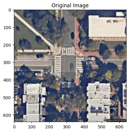
Figure 2: Original Photograph of a DC Intersection
Figure 2 shows an example of an intersection sourced from Google Earth. The objective is to extract as much insight as possible from these images such as identifying the type of intersection (diamond, cloverleaf, x-junction, etc.), analyzing the number of approaching roadways, assessing turning radii, evaluating crosswalk designs and intersection dimensions, and detecting any surrounding features or obstructions such as trees or bushes that could create safety hazards, especially at night with limited visibility.
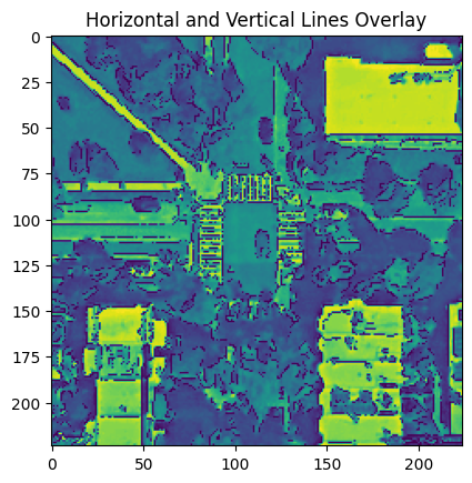
Figure 3: Horizontal and Vertical Lines Overlay on Intersection
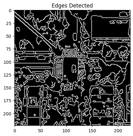
Figure 4: Edge Detection on Intersection
Figure 3 displays the Horizontal and Vertical Line Overlay and Figure 4 shows Edge Detection applied to the intersection from Figure 1. Both figures are intended to provide additional insight and data. Leveraging deep learning and neural networks, Nathan aims to develop models that can automatically detect and analyze these features from satellite imagery. This approach could potentially lead to models similar to those used in the crash prediction model but focused on identifying key safety elements at intersections, such as crosswalks and other critical safety features.
Both of Nathan’s projects contribute to DDS’s mission of using data to enhance road safety. The crash prediction model identifies the most dangerous road segments, allowing resources to be directed where they are needed most. Meanwhile, the satellite imagery analysis provides additional insights into intersections in DC, uncovering safety issues that might otherwise go unnoticed. Together, these projects offer a clearer understanding of traffic risks, ultimately making cities safer for everyone.
– DDS
Leave a Reply